INSPIRE Metadatensuche Österreich
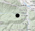
Almen Oberösterreich
Der Datensatz umfasst Almen die in den Oö. Almkataster eingetragen sind.
Dieser Datensatz wird über INSPIRE zur Verfügung gestellt.
Simple
- Alternate title
-
DORIS_WT.GISDB.ALMEN
- Date (Creation)
- 2013-11-01
- Date (Publication)
- 2013-11-01
- Date (Revision)
- 2018-04-19
- Citation identifier
- https://data.inspire.gv.at/0021/35B4CD72-9479-49F4-A56E-CE6F8ECCD4C7
- Presentation form
- Digital map
- Point of contact
-
Organisation name Individual name Electronic mail address Role Amt der OÖ. Landesregierung
DI, Helmut, Panholzer
Point of contact
- Maintenance and update frequency
- Unknown
-
GEMET - Concepts, version 2.4
-
-
Bodennutzung
-
-
OGD Kategorien
-
-
Land- und Forstwirtschaft
-
-
OGD Keyword
-
-
Bodennutzung
-
Statistik
-
Natur
-
Kataster
-
Landwirtschaft
-
Grenzen
-
Ortsangaben
-
Planungsunterlagen
-
HighValueDataset
- HVD
-
- Keywords
-
-
Bodennutzung
-
Statistik
-
Natur
-
Kataster
-
Landwirtschaft
-
Grenzen
-
Ortsangaben
-
Planungsunterlagen
-
HighValueDataset
-
Internetfreigabe
-
OGDFreigabe
- HVD
-
- Use constraints
- Other restrictions
- Other constraints
- Creative Commons Namensnennung 4.0 International (CC BY 4.0)
- Other constraints
-
Datenquelle: Land Oö., doris.at
- Access constraints
- Other restrictions
- Classification
- Unclassified
- Spatial representation type
- Vector
- Denominator
- 1
- Language
- Deutsch
- Character set
- UTF8
- Topic category
-
- Farming
- Economy
- Society
- Location
))
- Unique resource identifier
- EPSG:31255
- Unique resource identifier
- EPSG:3045
- Geometric object type
- Point
- Distribution format
-
Name Version gml+xml 3.2
- Distributor contact
-
Organisation name Individual name Electronic mail address Role Land Oberösterreich - Amt der OÖ- Landesregierung Point of contact
Digital transfer options
- OnLine resource
-
Protocol Linkage Name OGC Web Map Service
https://ags.doris.at/arcgis/services/INSPIRE/MapServer/WMSServer?request=GetCapabilities&service=WMS&version=1.3.0 INSPIRE Darstellungsdienst
ATOM Syndication Format
https://doris.ooe.gv.at/service/metadaten/DownloadDienstMetadataAtom.xml INSPIRE Downloaddienst
WWW:DOWNLOAD-1.0-http--download
https://e-gov.ooe.gv.at/at.gv.ooe.dorisdaten/DORIS_WT/ALMEN.zip Almen Oberösterreich
WWW:DOWNLOAD-1.0-http--download
https://www.doris.at/service/metadaten/daten/Almen_ETRS89TM33N.zip Almen Oberösterreich
OGC:WFS-http-get-capabilities
https://ags.doris.at/arcgis/services/HVD/MapServer/WFSServer?request=GetCapabilities&service=WFS Web Feature Service (WFS)
- Hierarchy level
- Dataset
Conformance result
- Title
-
Verordnung (EG) Nr. 1089/2010 der Kommission vom 23. November 2010 zur Durchführung der Richtlinie 2007/2/EG des Europäischen Parlaments und des Rates hinsichtlich der Interoperabilität von Geodatensätzen und -diensten
- Date (Publication)
- 2010-12-08
- Explanation
-
Dieser Datensatz entspricht den INSPIRE-Implementierungsregeln für die Interoperabilität von Geodatensätzen und -diensten
- Pass
- Yes
- Statement
-
Die Verortung erfolgte unter Zuhilfenahme von Unterlagen des Oö. Almkatasters sowie der Urmappe.
Metadata
- File identifier
- 35B4CD72-9479-49F4-A56E-CE6F8ECCD4C7 XML
- Metadata language
- Deutsch
- Character set
- UTF8
- Hierarchy level
- Dataset
- Date stamp
- 2026-04-13T09:35:54.975Z
- Metadata standard name
-
ISO 19115:2003/19139
- Metadata standard version
-
1.0
- Metadata author
-
Organisation name Individual name Electronic mail address Role Amt der OÖ. Landesregierung
DI, Helmut, Panholzer
Point of contact
- Dataset URI
-
H:\arcgis\Layerfiles\WirtschaftTourismus\Ortsangaben\Almen.lyr
Overviews
Spatial extent
Provided by